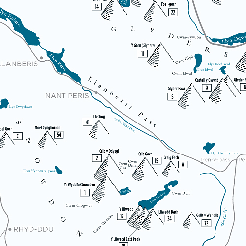
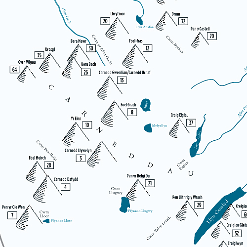
Mountains are drawn pictorially, the size of each illustration gives approximate representation of the height of the mountain. Each mountain is clearly labelled with name and number according to height.

Mountain table showing altitudes in metres and feet. The table documents mountain name, number and the area within Snowdonia.

All major lakes, valleys, cwms, roads and towns of the Snowdonia are shown to aid navigation.

Map is drawn approximately to a scale of 1 mile per 3/4 inch (2cm) and shows the North direction.
Feature List:
Specification:

